Direct APK 1.9.5

The latest WindFish improvements

  • The Moon shape follows its illumination percentage in the calendar, summary dial and Sun & Moon page.
  • The calendar shows Hijri months and year, plus the Hijri date of the selected day.
  • Delete community and booking accounts from their respective account areas, with confirmation.
  • Report reviews and block their authors in the community.
  • Open the privacy information and account-deletion page.
  • Latest shop catalogue, booking and Android notification fixes.
  • Android app available on Google Play; direct APK retained for existing installations.

Your logbook, private spots and settings stay on the device. Export a backup, then install the update without uninstalling WindFish.

Release and installation

Version 1.9.0 — Web app, detailed sky and updates

The website opens the actual Web app: fishing clock, marine weather, maps, spots, logbook, statistics, reports, bait and reviews. Android uses the same calculations. Browsing needs no account; posting reviews does.

A better explanation of the sky

Temperature in °C remains visible. Total, low, mid-level and high cloud cover are separated, with forecast sunshine per hour when supplied. Mainly-clear, partly-cloudy and overcast codes no longer share an identical icon. These remain forecasts, not observations at your spot.

Startup updates

For direct APK installations, this version checks the website release manifest. Google Play installations use store updates. A newer signed build is offered with release notes. Your action opens the download; then open the APK and confirm installation in Android. No silent download, uninstall or logbook reset.

Install this release once to enable checks for subsequent publications. A Web update loads by refreshing the page after saving edits. Browser and Android private logbooks are not automatically synchronized.
1.9.0 — Community ratings

New shared ratings for WindFish and documented spots. Optional accounts, recovery codes, one active review per account, public averages and distribution, revision protection, withdrawal, export and account deletion.

A real moderation dashboard lets authorised moderators publish, decline or hide reviews with a reason. Negative compliant reviews remain eligible. Activation requires the included private server setup; no account or review is prefilled.

EARLIER RELEASE HIGHLIGHTS

Sea, rain, clouds.
All in one place.

Marine layers use each model’s capabilities. Rain and clouds check their own data. The app starts online, with wind in km/h and a clear page when disconnected.

Available on Google Play · Français / English

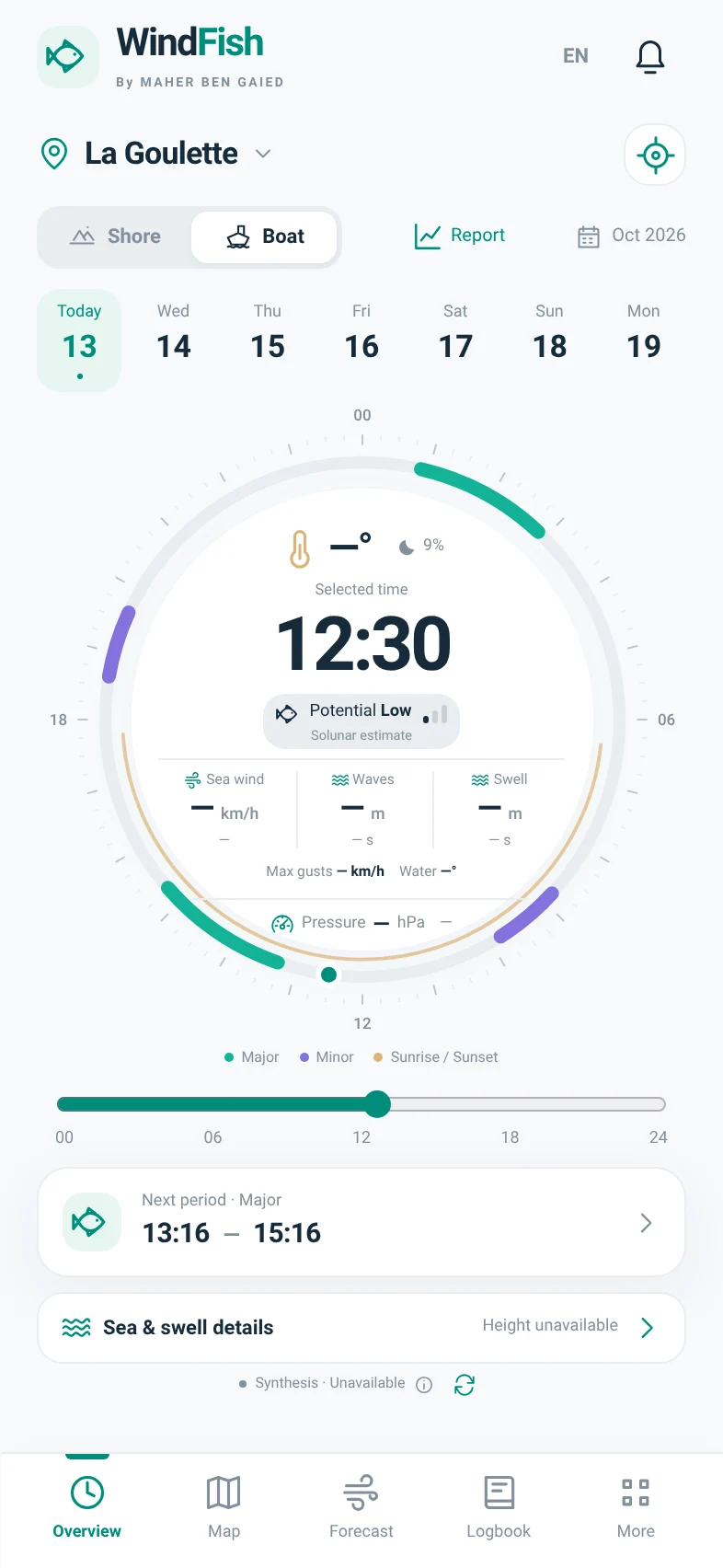
WindFish clock, solunar periods and conditions overview
1.9.0WIND · SPOTS · SYNTHESIS

WINDFISH 1.7 · NEW CATALOGUE

Real places. Visible sources.

Wrecks, rocks and coastal references: 35 documentary entries, 9 published locations, attributed photos and Google Maps links where positions are available.

Where GPS is not sufficiently established, the entry stays in the list without a fake marker. This catalogue is not exhaustive and does not prove current fish presence.

1.9.0

Corrected requests. Clearer errors.

Version 1.9.0 corrects the GFS Wave identifier and no longer requests swell from ECMWF WAM, which does not provide it in this API. Marine requests prefer sea cells. A wind cache no longer qualifies as loaded rain or clouds; one bounded targeted retry is available.

Read the map guide

01 · AROUND YOUR SPOT

A 3 km radius.
Your spot at the centre.

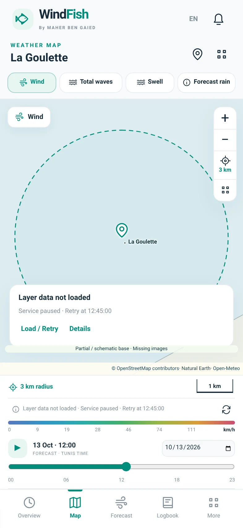
The map uses your selected spot coordinates, then fits the zoom to your screen. A dashed circle marks 3 km in every direction: 6 km across.

  • Centred on opening and when you select another spot.
  • 3 km button to return after manual panning.
  • Scale bar, pinch zoom and full screen remain available.
  • Explicitly selected GPS coordinates, never silently snapped to a town.
Explore the full module
WindFish weather map without received data

App interface · preview without received data

02 · BOAT MODE

Waves and swell.
Two distinct readings.

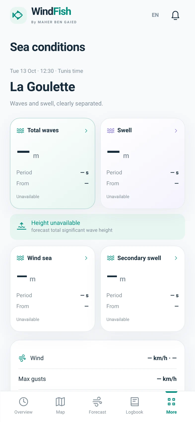
The Boat dial separates wind, total waves and swell. Sea details open four blocks and an hourly table so you can understand the components without mixing them.

  • Total waves: significant height, period and origin.
  • Swell and wind waves: each with its own readings.
  • Secondary swell when a source provides it.
  • Pressure, gusts, water temperature and currents close at hand.
Explore the full module
Separate total-wave, swell and wind-wave details

App interface · preview without received data

03 · WEATHER MAP

Wind takes on
a new dimension.

Colours represent speed and particles show wind movement. Explore the area, change the time and tap a point to inspect available information.

  • Zoom, pinch, full screen and point selection.
  • Wind, waves, swell, rain, clouds, air/water temperature and pressure.
  • Visible legend, source, time and grid spacing.
  • Automatic loading in the foreground while online; separate wind-animation and forecast-playback controls.
Explore the full module
WindFish weather map without received data

App interface · preview without received data

04 · PRESSURE & MODELS

No more choosing
a weather source.

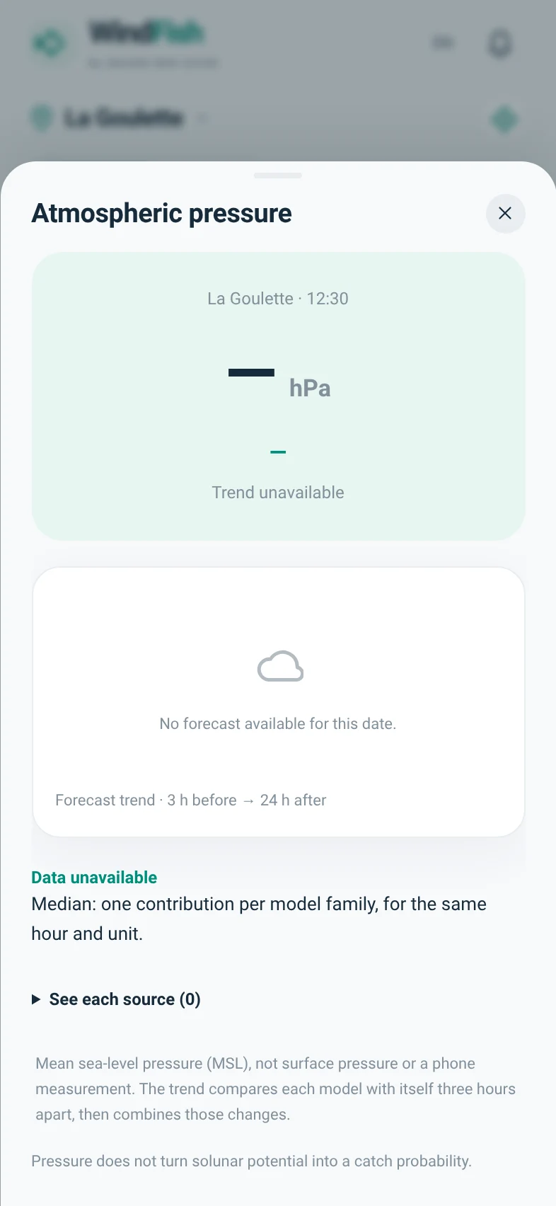
Pressure is shown on the dial in hPa. Its graph and forecast three-hour change are a tap away. The overview, forecasts and report share one synthesis.

  • Eight planned point feeds, queried automatically in the foreground while online.
  • Family median for continuous values, conservative gusts.
  • Directions combined only when compatible.
  • Disagreements and missing data remain visible.
Explore the full module
Atmospheric pressure and forecast trend

App interface · preview without received data

SATELLITE & PRECIPITATION

Three images.
Three different meanings.

A recent image is not always a live image. Every layer keeps its source and time.

Satellite — clouds

NASA MODIS · daily imagery

Natural-colour views from the dates announced in the catalogue. Clouds are not a rainfall measurement.

Understand this layer

Satellite rain

NASA IMERG · 30-minute steps

Past rainfall estimates published with a delay of several hours. Background and rain imagery can have different dates.

Understand this layer

Past radar

RainViewer · historical frames

Tunisian coverage needs checking for your area. Missing tiles or an unavailable service do not mean no rain.

Understand this layer

The integrations are implemented; real imagery access and performance still need verification on the phone. No continuous weather service or official warning delivery is guaranteed.

Your fishing essentials,
still right here.

Solunar clock, GPS and private spots, trips, logbook, recorded statistics, bait shops, dated announcements, local reminders and backups: the previous modules remain available.

Explore 31 modules and 37 indicators

TAKE WINDFISH WITH YOU

Your next outing
starts here.

The Android app, in your pocket. The Tunisian coastline, at your fingertips.

Get it on Google Play
—Website APK downloads · excludes Google PlayLoading…
Google PlayAndroidFR / EN

WindFish is available on Google Play. Install the app and get its updates through the store.

Direct APK 1.9.5 · File details and checksum. For existing direct installations. This file is separate from the version distributed by Google Play.

Release details, installation and file integrity
01

Open Google Play

Open the WindFish listing on your Android phone.

02

Install WindFish

Tap Install in Google Play, then open WindFish.

03

Choose your spot

Select a location, then Shore or Boat. Online access and wind in km/h are the defaults.

QR code to the Android download instructions
From desktop to phone.

Scan to open the instructions. The download starts only after you tap its button.

All useful links

Already installed? Back up your logbook, then install as an update. Do not uninstall WindFish or clear its data.