From the shore
Beach, rocks or a pier: start with the place, then bring wind, waves and timing together.
- Surfcasting · Spinning · Bottom fishing
- Nearby and private spots
- Bait and outing preparation
FISHING, THE TUNISIAN WAY
Now on Google PlayFrom shore to open water: animated wind, separate waves and swell, pressure and automatic synthesis. Explore a 3 km radius around your spot and prepare your outing.
Now on Google Play · Français / English
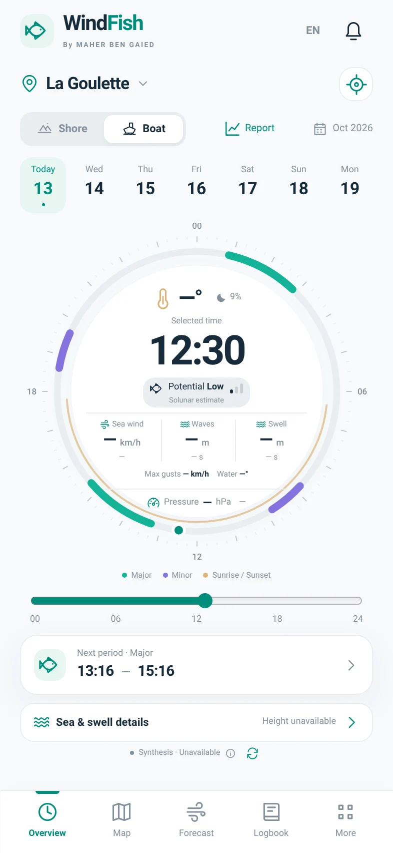
Actual interface, preview without received data. No invented weather.
to read your day
supported indicators¹
included coastal references
modes: Shore & Boat
Direct APK 1.9.5
Your logbook, private spots and settings stay on the device. Export a backup, then install the update without uninstalling WindFish.
Release and installationWINDFISH 1.7 · NEW CATALOGUE
Wrecks, rocks and coastal references: 35 documentary entries, 9 published locations, attributed photos and Google Maps links where positions are available.
Where GPS is not sufficiently established, the entry stays in the list without a fake marker. This catalogue is not exhaustive and does not prove current fish presence.
ALREADY IN WINDFISH
YOUR WAY TO FISH
WindFish adapts the context to your fishing, without multiplying your apps.
Beach, rocks or a pier: start with the place, then bring wind, waves and timing together.
Departure, fishing period, return: keep conditions in view across the entire planned outing.
Places are references, not verified access points. Check access, restrictions and actual conditions before you go.
THE WINDFISH EXPERIENCE
A clean interface with connected modules. Explore the app’s screens.
A 24-hour dial brings together the selected time, solunar potential, wind, waves and atmospheric pressure. Boat mode gives swell its own reading, separate from total waves.
Overview → clock

Wind and gusts stay separate. The overview and forecasts now use an automatic synthesis of the model families received, with no manual provider selection.
Forecast / Overview → wind
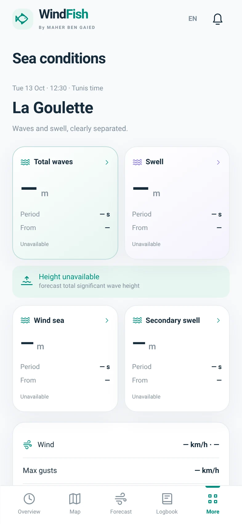
Boat mode separates total waves, swell, wind waves and secondary swell. Each block exposes height, period and origin when supplied by the models.
Boat → Sea & swell details / Map → Waves or Swell
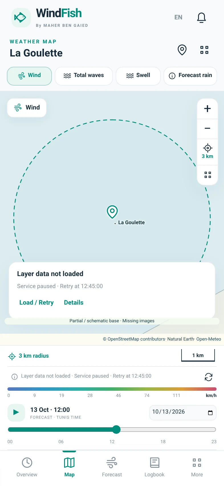
Colours represent available speed and particles show wind travel direction across the viewed area.
Map → Layers → Wind

Move from wind to sea conditions, then rainfall and atmospheric variables, without changing apps.
Map → Layers
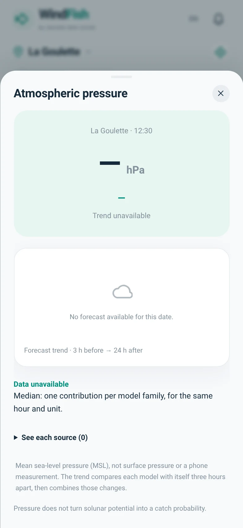
Mean sea-level pressure appears in hPa with an arrow showing its forecast three-hour change.
Overview → Pressure / Map → Pressure

Use the position returned by your phone to rank available references. Then choose whether to use your actual position or select a listed spot.
GPS icon → Nearby spots

Bring conditions, periods, preparation and sources together for your planned duration. The report keeps the whole outing in view, not just departure time.
Overview → Report / More → Outing report

Discover mapped businesses around a fishing spot, town or your position, then build your own supplier directory.
More → Bait / Map → Bait

Start a session or add a past outing. Zero-catch sessions belong here too: they give meaning to recorded fishing effort.
Logbook
Screens rendered from the 1.9.0 code in a browser without connected forecasts. Real forecasts and imagery depend on services and connectivity; this preview does not simulate weather.
READING THE SOURCES
Sources are combined automatically. One consistent synthesis feeds the dial, forecasts and reports; original values remain available to inspect.
Models delivered through Open-Meteo. Not a list of partners.
Understand automatic synthesisAvailable variables for the location and duration.
Units, dates, context and missing information.
Family medians, compatible directions and conservative gusts.
Named sources and visible limits in the report.
EVERYTHING CONNECTS
The right tool at every step, without crowding the overview.
Put your outing in the rhythm of the day.
Plan beyond tomorrow.
Place, timing and practical details.
Turn an announcement into dated information.
Results, with their sample.
Online by default. Your records stay yours.
MADE FOR TUNISIA
From Tabarka to Zarzis, start with a coastal reference or choose your own coordinates in the supported area.
References help select an area; they do not certify fishing access. Forecast coverage depends on each provider.
Explore GPS & nearby featuresTabarka · Bizerte · Ghar El Melh
La Marsa · La Goulette · Radès
El Haouaria · Kélibia · Hammamet
Sousse · Monastir · Mahdia
Sfax · Kerkennah
Gabès · Djerba · Zarzis
Editorial coastline overview · not a navigation chart
INFORMATION THAT KEEPS ITS MEANING
The solunar badge describes astronomical windows. Your success is not reduced to a colour.
Posts retain their date and source. Call the supplier before travelling.
Sessions stay local. You choose whether to export or share, and with whom.
WindFish helps prepare an outing. It is not a marine navigation chart or a safety guarantee.
TAKE WINDFISH WITH YOU
The Android app, in your pocket. The Tunisian coastline, at your fingertips.
WindFish is available on Google Play. Install the app and get its updates through the store.
Direct APK 1.9.5 · File details and checksum. For existing direct installations. This file is separate from the version distributed by Google Play.
Release details, installation and file integrityOpen the WindFish listing on your Android phone.
Tap Install in Google Play, then open WindFish.
Select a location, then Shore or Boat. Online access and wind in km/h are the defaults.
Scan to open the instructions. The download starts only after you tap its button.
All useful linksAlready installed? Back up your logbook, then install as an update. Do not uninstall WindFish or clear its data.
FREQUENT QUESTIONS
No account is needed for forecasts, the local logbook or spots. An optional account is required to submit or moderate reviews. No paid API key is added; provider terms, including personal/non-commercial use, still apply.
Weather features are online by default. A connection page appears if the phone reports it is offline. The logbook, saved spots and settings are retained; backup export remains accessible. A service failure may produce a distinct message.
Models, valid times, grid points, land/sea preference and units may differ. WindFish separates wind from gusts and lets you inspect sources. It does not adjust a value merely to match another app.
No. It means the selected time falls in a calculated major solunar period. It is not a catch probability, fish detection or safety advice.
The module retains announcements, their sources and your private checks. A dated announcement does not guarantee stock when you arrive. No live merchant inventory is connected by default.
The Google Play version is for Android. On an iPhone or computer, open WindFish Web in your browser. Your logbook stays on each device or browser; use Export / Import to transfer it.
For Google Play installations, use the updates offered by the store. For a direct APK installation, export a JSON backup and use a compatible update from the same channel. Do not uninstall the app or clear its data. Do not force installation after a signature error.
No certified marine navigation, live merchant-stock feed or unrestricted automatic Facebook collection. NOAA/MET relays, direct Copernicus ingestion, EMODnet layers and INM warning ingestion are not connected by default.
¹ The engine supports 31 indicator types. Availability depends on source, location, time and connectivity. A missing value is never treated as zero.
WINDFISH · COMMUNITY
Rate WindFish and the documented spots. One active review per account and subject; published reviews only count toward the average.
Read or write a reviewA community opinion, not a fish-activity forecast or a Google Play score.
The same functional clock, weather and marine maps, detailed sky, local logbook, statistics, trips, bait, documented spots and moderated reviews as the shared Android interface. Private browser data are not automatically synchronized to your phone. Background Android reminders remain Android-only.
Cloud coverage, low/mid/high layers and forecast sunshine help distinguish cloudy intervals from a completely overcast sky. Temperature stays visible in °C. Forecasts are not local measurements.
Google Play installations receive updates through Google Play. Direct APK installations retain their website update channel. Back up your logbook before updating.
Open detailed sky Updates and settings